A new mapping tool shows critical energy infrastructure in the U.S., such as power plants, refineries, and crude oil rail terminals, that may be vulnerable to coastal and
inland flooding, as well as areas that may be prone to flooding in the future. The maps, created by the U.S. Energy Information Administration and the Federal Emergency Management Agency, let users see which energy facilities could be in danger of flooding caused by hurricanes, flash floods, and other weather events, including street-level results for a particular address. The maps show areas that have a 1-in-100 (1 percent) and 1-in-500 (0.2 percent) chance of flooding annually, as well as areas that might be identified in the future as having a 1-percent annual flood hazard.
Click to Enlarge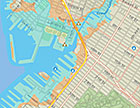
Brooklyn, NY, flood risks