A new NASA project will use satellite data to better monitor how much water is fed into river systems across the Himalayan region through snow and glacier melt, an initiative that could help provide early warnings on flooding and drought across South Asia. Using satellite observations of snow and glacial melt, the so-called HIMALA project will generate daily snow/water equivalence maps that will then be fed into other hydrological models that monitor how much freshwater is entering the region’s major rivers, including the Ganges and the Indus. While the Himalayan glaciers serve as a freshwater reservoir for more than 1.3 billion people, scientists say those water resources will increasingly be affected by climate change, population growth, urbanization, and changes to land use. Results from the HIMALA project also could be used to improve drinking water quality and availability and devise climate adaptation and mitigation strategies. A report on the project was published in the journal BioOne.
Click to enlarge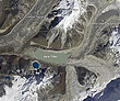
NASA
Glacial lake in eastern Nepal