The U.S. Forest Service is using NASA satellite images of fires in the American West to help rapidly restore burned areas before the upcoming rainy season causes floods and washouts that could threaten lives and property.
This image of the Silver Hill fire in New Mexico, which burned 138,000 acres in June, was taken using infrared technology — mounted on NASA’s Landsat satellite — that distinguishes between vegetated and burned areas. The most severely burned areas are depicted in red, followed by areas of moderate-severity burn in yellow and low-severity burn in green. NASA began supplying the Forest Service with images as the fire raged, and in the wake of the fire the Forest Service has undertaken restoration efforts to stabilize the ground and prevent flooding during the rainy season in late summer.
Click to enlarge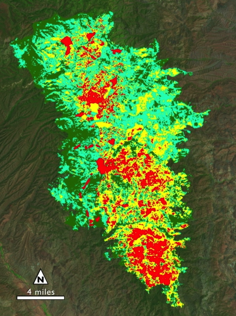
U.S. Forest Service
Satellite image of Silver Fire