As high-tide flooding worsened in Norfolk, Virginia in recent years, Margaret Mulholland, a biological oceanographer at Old Dominion University, started to think about the debris she saw in the waters that flowed back into Chesapeake Bay. Tipped-over garbage cans. Tossed-away hamburgers. Oil. Dirty diapers. Pet waste.
“This water is coming up on the landscape and taking everything back into the river with it,” says Mulholland, a professor in the Department of Ocean, Earth, and Atmospheric Sciences. “I was thinking how no one is counting this stuff (as runoff pollution). It drove me nuts.”
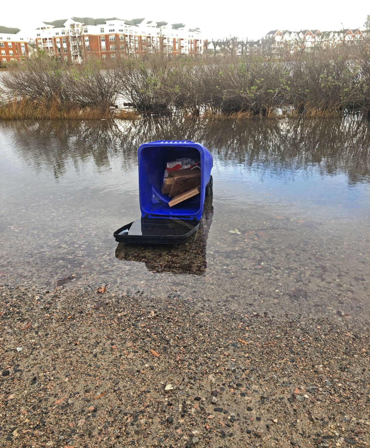
Nuts enough that she decided to sample those waters. That’s why on a recent Saturday morning she was steering her Chevy Bolt EV toward a narrow, flooded ribbon of Norfolk’s 51st Street at high tide. Marsh grasses bordered an inlet of the Lafayette River on one side of the street. A line of houses set back from the street rose on the other. Soon she came upon an overturned trash can, its contents underwater. A few feet away was a box. She opened it, and inside was a toilet. “Oh, this is good,” she said, pulling out her phone for a photo.
High-tide flooding frequency along the southeastern coast of the U.S. rose 160 percent from 2000 to 2017.
It’s an apt metaphor for her pioneering research project, which she has dubbed Measure the Muck.
With global sea levels steadily rising — already up 8 inches in the past century and now increasing at an average of 1.3 inches per decade — the incidence of high-tide “sunny day” or “blue sky” flooding is on the rise, especially along the U.S. East Coast. Those flooding events now routinely wash over sections of cities, and when the waters recede they take with them an excess of nutrients and a toxic mix of pollutants that flows into rivers, bays, and oceans.
Norfolk, which experienced fewer than two days of high-tide flooding annually in the early 1960s, had 14 in 2017. In Wilmington, North Carolina, tidal flooding grew to 84 days in 2016, up from two days 50 years ago. In Lewes, Delaware at the mouth of Delaware Bay, flooding days have topped 25 in recent years, a five-fold increase over a decade ago. In Charleston, South Carolina, the incidence of sunny day flooding increased to 50 days in 2016, up from four days annually 50 years ago, causing millions of dollars in damage and disrupting travel to the city’s hospital district. In Miami, sunny day flooding is becoming increasingly severe, accelerating to nearly 20 days a year. In Philadelphia, tidal flooding due to rising sea levels was responsible for 83 out of 120 days of flooding from 2005 to 2014.
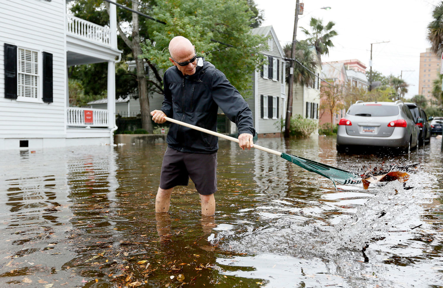
An overturned trash can sits in high-tide floodwaters on 52nd Street in Norfolk, Virginia. Margaret Mulholland
According to a report from the National Oceanic and Atmospheric Administration (NOAA), high-tide flooding frequency along the southeastern coast of the United States rose 160 percent from 2000 to 2017. And with sea levels expected to rise another 3 to 6 feet by 2100 because of melting ice sheets and glaciers, scientists warn that much worse is to come. NOAA projects that as many as 85 days of high-tide flooding will occur annually along the southeastern U.S. coast by 2050.
Until Mulholland, however, few if any researchers had examined exactly how much pollution this sunny day flooding was creating. And what Mulholland found shocked her. Analysis of water samples indicates that one morning of tidal flooding along the Lafayette River in Norfolk poured nearly the entire annual U.S. Environmental Protection Agency allocation of nitrogen runoff for the river — 1,941 pounds — into Chesapeake Bay.
“That’s striking,” she says. “How do we expect to restore the bay if we’re not counting a lot of what’s going in?”
Researchers didn’t consider pollution from blue-sky flooding until recently because it wasn’t a recurring problem.
Mulholland is focused on measuring nitrogen, including ammonium, because of its effect on algae blooms, which create oxygen-depleted dead zones in bay waters. She said that other pollutants — including oil, gasoline, and trace metals — are also washing into waterways, as evidenced by the petroleum sheens visible on the water during high-tide flooding. “We can see it, and it would be great if we could measure it in the future,” she says. “But we don’t have the analytical chops to measure it so far.”
Marjorie Friedrichs is an associate professor at the Virginia Institute of Marine Science who studies nutrient pollution and hypoxia in the bay using computer models. She lived in Norfolk for years and routinely had to walk through streets inundated by sunny day flooding. “You hit yourself on the head — why haven’t we thought about this?” she says of the pollution problem associated with high-tide flooding. “It’s fascinating work. It’s a nutrient source we haven’t considered at all in our model. I’m interested in adding that to our model and seeing what the impact on hypoxia is.”
Hypoxia is decreased oxygen in the water resulting from algae blooms caused by excessive nitrogen and phosphorous. According to the Chesapeake Bay Foundation, a single hypoxia incident in 2007 caused the deaths of roughly 300,000 fish in one creek, including menhaden, shad, American eel, and largemouth bass.
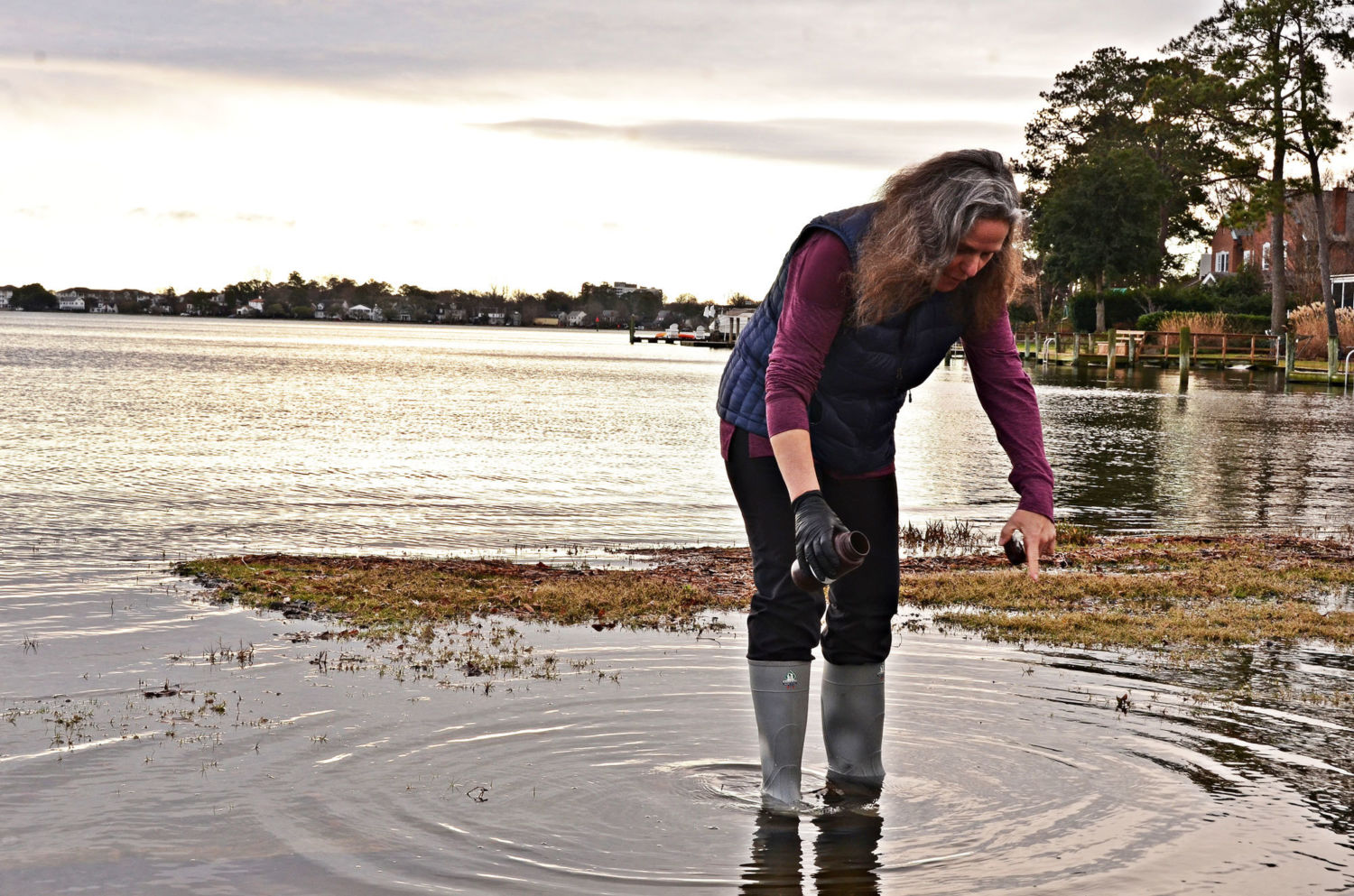
Scientist Margaret Mulholland collects a water sample from high-tide flooding in Norfolk in January. Jim Morrison/Yale e360
Researchers didn’t consider pollution from blue-sky flooding until recently because it wasn’t a recurring problem. But Mulholland started thinking about the issue while mapping tidal flooding with an app developed for Wetlands Watch, a nonprofit group that helps local governments adapt to sea level rise. Then, in late 2017, Mulholland realized that a crowdsourced project to map the inundation from the highest tide of the year, known as a king tide, presented an opportunity to advance her research.
She partnered with the project, “Catch the King,” training high school and university students who collected 213 samples to measure salinity, nitrogen, and suspended solids, among other things. Each time volunteers took a sample, they shot a photo of the location and recorded it on a GPS. “No one has done this sort of thing before because you need to have all the people on the ground at the same point in the tidal cycle,” she says.
Using tidal flooding models created by researchers at the Virginia Institute of Marine Science, Mulholland and her team calculated the amount of water on the land during the King Tide sampling and came up with the load of nutrients flowing into the bay. They conservatively estimated that about 1,800 pounds of ammonium and nitrate were delivered to the Lafayette River during the single high tide.
Mulholland repeated the sampling during the Catch the King effort in October 2018. While that analysis is not yet complete, she found similar quantities of nutrients flowing into the bay.
Of 40 water samples tested for enterococcus — an indicator of fecal material — only three met the safe-swimming standard.
Mulholland has identified eight locations along the Lafayette River in Norfolk that flood during high tide that she and her students can visit regularly to examine the range of nutrients washing into the river under different conditions. She keeps sample bottles in her car so she’s ready when high-tide flooding occurs. At one spot, where homes have been raised on cinderblocks because of more frequent sunny day flooding, she points out a For Sale sign that has sat for months in front of one of the at-risk houses. At a third spot near a boat launch, she says waters routinely flood both an apartment building parking lot filled with cars, often up to their doors, and a dog park across the street. She gestures to another spot where she once saw dog waste in the water and children jumping off a pier as she took a sample.
As we drove from one site to another, Mulholland said that tidal flooding may also be a public health concern. Of 40 samples tested in 2017 for enterococcus — an indicator of fecal material that can cause severe urinary tract infections — only three met the safe-swimming standard. Seven of the samples had such high levels of enterococcus that they exceeded the equipment’s ability to accurately measure the concentrations.
Friedrichs is eager to plug the numbers into her model. “If this is occurring in Norfolk, it’s also occurring in other places in the bay,” she says. “We need to know how many nutrients go into the bay to see what the impact is on water quality.”
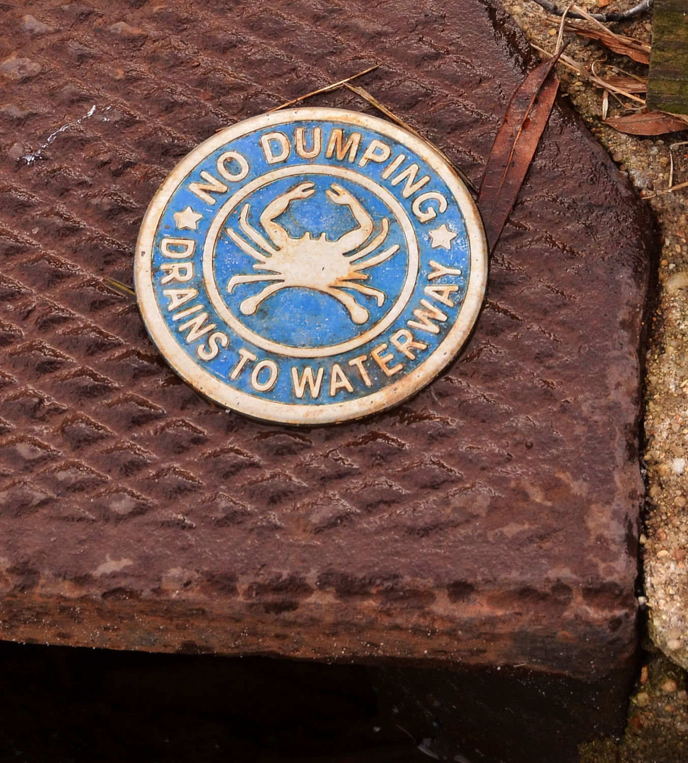
A street drain cover in Norfolk. High levels of fecal matter, nitrogen, and other nutrients have been found in the city's high-tide floodwaters. Jim Morrison/Yale e360
Carol Collier, senior advisor for Watershed Management and Policy at Drexel University’s Academy of Natural Sciences in Philadelphia, served on the Delaware River Basin Commission for more than 15 years. She said it would be useful to replicate Mulholland’s work in Delaware Bay and the Delaware River. The funnel shape of Delaware Bay amplifies the effect of sea level rise on tides. Coupled with channel dredging, that means that tidal ranges — the difference between low tide and high tide — have increased significantly upstream. Today, for instance, the range is more than 6 feet in Philadelphia, an increase of a foot-and-a-half in the past century. With brownfields and industrial sites on both sides of the river, Collier says that pollution from tidal flooding is an issue that needs to be investigated.
Chris Moore, a senior scientist for the Chesapeake Bay Foundation, says he is looking forward to more results from Mulholland. Understanding nutrient loads from urban areas has been difficult to quantify, he says. Mulholland’s work could lead to targeting specific locations with high nutrient loads for mitigation through living shorelines or buffers that use vegetation to help trap sediment and filter water flowing back into rivers and bays.
“Things that we can do to stretch our restoration dollars further and deal with some of these specific issues are only going to make our restoration efforts more successful and help improve water quality faster,” he says.
Mulholland is happy the issue is getting attention. “When we think of sea level rise, we think of what is at risk on the land side, where we live and have to get around,” she says. “[But] anything left on the land here is going back in the water. Anything. It’s gravity.”