The Manantali Dam is estimated to have caused the loss of 90 percent of fisheries and up to 618,000 acres previously covered by water.
Last year, I traveled with Wetlands International, a Dutch-based environmental NGO, along the valley of the River Senegal, which forms the border between Senegal and Mauritania. Farmers, herders, and fishermen told of their battles against the ecological breakdown that has followed the building of the Manantali Dam, which is located upstream in Mali and was completed in 1987. The dam holds back a large part of the river’s seasonal flood flow to generate hydroelectricity for cities and provide irrigation water for some farmers. But there have been more losers than winners.
Seydou Ibrahima Ly, a teacher in the bankside village of Donaye Taredji in Podor district, said that when he was young, “the river had a flood that watered wetlands where fish grew.” But “now there is no flood because of the dam… Compared to the past, there aren’t many fish. Our grandparents did a lot of fishing, but we don’t.” With their livelihoods gone, more than 100 people had left his village, he said. “In some villages, they are almost all gone.”
“The migrants know the boats [traveling to Europe] are dangerous, but they have a determination to go and find a better life,” said Oumar Cire Ly, deputy chief of neighboring Donaye village, which has also seen an exodus of its young people.

Donkeys on a dried-out section of the Inner Niger Delta in Mali. Fred Pearce/Yale e360
Farmers once planted their crops in the wet soils as the waters receded. Pastoralists grazed their animals where forests and wildlife flourished. But the dam and its related projects are estimated to have resulted in the loss of 90 percent of the fisheries and up to 618,000 acres of fields that were previously covered by water from the rising river during the wet season, a system of natural irrigation known as flood-recession agriculture.
The Senegal River Basin Development Organization – the intergovernmental agency that is responsible for the dam project and is known by its French acronym, OMVS – conceded in 2014 that eliminating the river’s annual flood “has made flood-recession crops and fishing on the floodplain more precarious, which makes the rural production systems of the middle valley less diversified, and therefore more vulnerable.”
This is clearly at odds with the organization’s mandate to “ensure food security for all people within the river basin and region.” But Amadou Lamine Ndiaye, the OMVS’s director of environment and sustainable development, told me his agency regarded wetlands such as river floodplains primarily as a source of revenue for tourists, rather than as a lifeline for rural communities.
As many as a million Nigerians have lost livelihoods because of dams that once fed a wetland that flowed into Lake Chad.
Worse still is the crisis affecting the region around Lake Chad, which until half a century ago was Africa’s fourth largest lake, straddling the border between Nigeria, Niger, Chad, and Cameroon. The lake has lost more than 90 percent of its surface area since then. Initially, this was largely due to persistent droughts in the Sahel that often dried up the rivers supplying it with water. Since 2002, rainfall has improved markedly, but Lake Chad has not recovered.
That is because of dams on the rivers flowing into the lake from the wetter south, mainly in Cameroon and Nigeria. The Maga Dam in Cameroon has diverted 70 percent of the flow of the Logone river to rice farms. This has both dried up part of the floodplain pastures that once supported 130,000 people, and dramatically reduced inflow to Lake Chad.
In northern Nigeria, up to 1 million people have lost livelihoods because of dams on the River Yobe that once fed the Hadejia-Nguru wetland and flowed on into Lake Chad. In both cases, says Edward Barbier, an environmental economist at Colorado State University, the dams have had an overall negative effect on local economies, as losses to fishermen, pastoralists, and others exceeded gains from irrigation agriculture.

The major wetlands and water basins of the Sahel region in Africa. Wetlands International
The poverty is driving social breakdown and conflict all around the lake. Mana Boukary, an official of the Lake Chad Basin Commission, an intergovernmental body, told Duetsche Welle two years ago: “Youths in the Lake Chad Basin are joining Boko Haram because of lack of jobs and difficult economic conditions resulting from the drying up of the lake.”
The UN humanitarian coordinator for the Sahel region, Toby Lanzer, told a European Union-Africa summit that it was also fueling migration: “Asylum seeking, the refugee crisis, the environmental crisis, the instability that extremists sow — all of those issues converge in the Lake Chad basin.”
A Nigerian government audit of the lake basin in 2015 agreed. It concluded that “uncoordinated upstream water impounding and withdrawal” were among factors that had “created high competition for scarce water, resulting into [sic] conflicts and forced migration.” More than 2.6 million people have left the Lake Chad region since mid-2013, according to the International Organization for Migration.
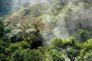
At their greatest extent, wetlands cover one-tenth of the Sahel, the arid region stretching for 3,400 miles across northern Africa, immediately south of the Sahara desert. They are wildlife havens, especially notable for their birdlife. The Inner Niger Delta in Mali, for instance, is one of the world’s most important seasonal stops for migrating birds, hosting about 4 million waterbirds from Europe each winter. In addition, these wetlands are a source of sustenance for the region’s poor and the main sources of the region’s economic productivity outside the short wet season from June to September.
Dried-up wetlands are often blamed on climate change when the real cause often is more human interference in river flows.
Yet the decline of the wetlands and the resulting social and economic consequences remains a largely untold story. That is partly because dried-up wetlands are routinely, and often incorrectly, blamed on climate change, when the real cause is often more direct human interference in river flows. It is also partly because many development agencies still mostly think of dams as infrastructure development that furthers economic activity and wealth – and partly because many environmental groups concentrate on the ecological impacts of dried wetlands, while ignoring the human consequences.
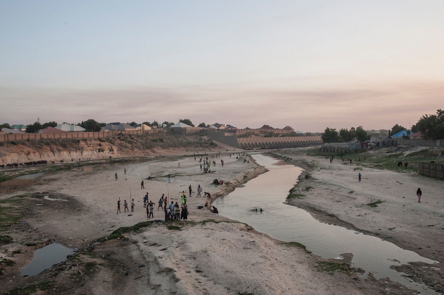
In this climate of ignorance, more wetlands are under threat. The next victim is likely to be the Inner Niger Delta, a wetland in northern Mali that covers an area the size of Belgium. The delta forms where West Africa’s largest river, the Niger, spreads out across flat desert near the ancient city of Timbuktu.
The delta is a magnet for migrating European waterbirds. It is also currently one of the most productive areas in one of the world’s poorest countries. It provides 80 percent of Mali’s fish and pasture for 60 percent of the country’s cattle, and it delivers 8 percent of Mali’s GDP and sustains 2 million people, 14 percent of the population, says Dutch hydrologist Leo Zwarts. Its fish are exported across West Africa from Mopti, a market town on the shores of the delta.
In recent years the Mali government has been diverting water from the River Niger at the Markala barrage just upstream of the delta, to irrigate desert fields of thirsty crops such as rice and cotton. These diversions have cut the area of delta flooded annually by up to 7 percent, says Zwarts, causing declines in forests, fisheries, and grazing grasses. Some people have left the delta as a result, though it is unclear whether they have been among the Malians regularly reported to be in migrant boats heading from Libya to Italy.

The Markala Barrage in Mali, which diverts water from the River Niger for irrigating crops such as rice and cotton. Fred Pearce/Yale e360
But this trickle of people from the delta could soon become a flood. In July this year, Mali’s upstream neighbour, Guinea, announced the go-ahead for Chinese firms to build a giant new hydroelectric dam, the Fomi Dam, in the river’s headwaters. Construction could begin as soon as December.
The Fomi Dam’s operation will replace the annual flood pulse that sustains the wetland’s fecundity with a more regular flow that the Mali government intends to tap for a long-planned tripling of its irrigation along the river. Wetlands International estimates that the combined impact of the dam and irrigation schemes could cut fish catches and pastures in the delta by 30 percent.
“Less water flowing into the delta means a lower flood level and a smaller flood extent”, says Karounga Keïta of Wetlands International in Mali. “This will have a direct impact on food production, including fish, livestock, and floating rice.” He fears that the inevitable outcome will be further human migrations from the wetland.
The links in the chain from water management through wetland health to social breakdown and international migration are complex. Wetland loss is certainly not the only reason for the human exodus from the Sahel. And migration is a long-standing coping strategy for people living in a region of extreme climate variability.
But the parlous state of the wetlands of the Sahel is changing the region. In the past, wetlands were refuges in times of drought or conflict. They were safe, and the water persisted even in the worst droughts. But today, with their waters diminished, these wetlands have become sources of outmigration. Now, migrations that were once temporary and local are becoming permanent and intercontinental.
The author’s travel to Senegal to report this article was supported by Wetlands International.