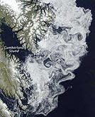
Every day, NASA’s Earth Observatory publishes images of our world from a perspective rarely seen by human eyes — from satellites high above the planet’s surface. In 2009, these images once again provided an extraordinary view of the powerful forces of nature, of the widening footprint of human civilization, and of the point where they often meet. In February, NASA satellite photos captured the massive brushfires roaring through southeastern Australia. Two months later, the space agency’s cameras documented the Aral Sea’s disappearance. The images expanded our view of how human land use is reshaping our world, from the patchwork farms of the U.S. Midwest to the building boom in Dubai. And the photographs illustrated that, from miles above, even the murky sediment in the Gulf of Mexico or a violent sandstorm off the Senegal coast can have a delicate beauty. Click to see a gallery of some of the more memorable images from the year.
NASA: The Year in Images
More From E360
-
Biodiversity
As Jaguars Recover, Will the Border Wall Block Their U.S. Return?
-
WATER
An E.U. Plan to Slash Micropollutants in Wastewater Is Under Attack
-
INTERVIEW
This Data Scientist Sees Progress in the Climate Change Fight
-
Climate
As Floods Worsen, Pakistan Is the Epicenter of Climate Change
-
Climate
Heat Stress Is a Major Driver of India’s Kidney Disease Epidemic
-
Energy
It’s a ‘Golden Age’ for U.S. LNG Industry, But Climate Risks Loom
-
Climate
How Climate Risks Are Putting Home Insurance Out of Reach
-
INTERVIEW
Inside the Plastics Industry Playbook: Delay, Deny, and Distract
-
Biodiversity
Freeing Captive Bears from Armenia’s Backyards and Basements
-
Food & Agriculture
In Indonesia’s Rainforest, a Mega-Farm Project Is Plowing Ahead
-
FILM CONTEST WINNER
In the Yucatan, the High Cost of a Boom in Factory Hog Farms
-
INTERVIEW
In the Transition to Renewable Energy, China Is at a Crossroads