New Google Earth maps enable the public and scientists to observe sections of the ocean floor — often mapped less finely than the Moon or Mars — with a resolution ten times greater than previous ocean floor mapping projects. Developed by oceanographers at Columbia’s
Lamont-Doherty Earth Observatory, the new three-dimensional maps piece together high-resolution seafloor images taken during hundreds of research cruises covering roughly 3 million miles. The maps, which cover roughly 5 percent of the ocean floor, provide detail in 100-meter grids, compared to previous maps with 1-kilometer grids. The maps offer detailed views of such prominent underwater features as the Hudson Canyon off New York City and the 10,000-foot Mendocino Ridge off the West Coast of the U.S. The maps also have important scientific value, enabling researchers to more clearly see details of earthquake faults and underwater landslides, which commonly trigger tsunamis. The maps also focus on erupting mid-ocean ridges to advance understanding of volcanic activity, most of which occurs underwater. The project will continue to map the world’s sea bottom, using data — including multi-beam sonar images — from U.S. and international research cruises.
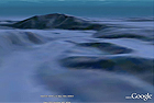
Detailed View of Seafloor Depicted in New Google Earth Maps
More From E360
-
MINING
In Coal Country, Black Lung Surges as Federal Protections Stall
-
Biodiversity
Older and Wiser: How Elder Animals Help Species to Survive
-
Climate
Rusting Rivers: Alarm Grows Over Uptick in Acidic Arctic Waters
-
ANALYSIS
A More Troubling Picture of Sea Level Rise Is Coming into View
-
INTERVIEW
Why Protecting Flowering Plants Is Crucial to Our Future
-
OPINION
Trying Times: Keeping the Faith as Environmental Gains Are Lost
-
ANALYSIS
As It Boosts Renewables, China Still Can’t Break Its Coal Addiction
-
OPINION
Can America’s Wolves Survive an Onslaught of Political Attacks?
-
MINING
As Zambia Pushes New Mining, a Legacy of Pollution Looms
-
Biodiversity
Long Overlooked as Crucial to Life, Fungi Start to Get Their Due
-
ANALYSIS
Species Slowdown: Is Nature’s Ability to Self-Repair Stalling?
-
OPINION
Beyond ‘Endangerment’: Finding a Way Forward for U.S. on Climate