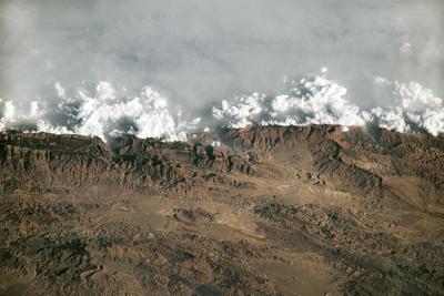
A satellite image of haze from cities in the Indus River Valley colliding with the Sulaiman Mountains in Pakistan. NASA
Last year saw warming reach startling new highs, with record heat fueling extreme weather around the world. As farms and cities grow, pollution is spreading and overheating the planet. The evidence of our impact is so profound that it can be seen from space.
These satellite images shared by NASA’s Earth Observatory over the last year show the staggering human footprint.
Farms
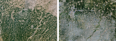
Farms and pastures account for almost half of the world’s habitable land, meaning those parts not covered by ice or desert. And recent years have seen a boom in greenhouses, which now cover 3.2 million acres, an area the size of Connecticut. The images below show the profusion of greenhouses in China.
Satellite images of farmland in Weifang, China, in 1987 (left) and 2024 (right), after a boom in greenhouses. NASA
Cities
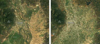
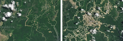
More than half of people on Earth live in cities, which are expanding at a rapid clip, especially in the developing world. The images below show the growth of Chiang Mai, Thailand, and the development of the new Indonesian capital of Nusantara, built because the existing capital, Jakarta, is mired in traffic and pollution and facing worsening floods as seas rise and the city slowly sinks.
Climate Change
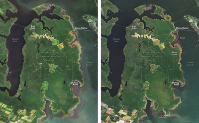
This year emissions and temperatures are both expected to hit an all-time high. As the world reaches these grim new milestones, the effects of warming are evident. Seas are rising, ice is melting, and wildfires continued to burn through tropical forests. The photos below show woodlands withered by floods in North Carolina, the disappearance of the last glacier in Venezuela, and massive burns in the Pantanal wetlands of Brazil.
Alligator River National Wildlife Refuge in 2005 (left) and 2024 (right). Rising seas have flooded coastal woodlands, creating "ghost forests." NASA
Pico Humboldt in Venezuela in 2015 (left) and 2024 (right), after the Humboldt Glacier melted away. NASA
False-color images of the Pantanal region of Brazil before (left) and after (right) wildfires in June. NASA
Renewable Energy
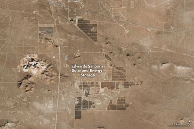
Amid the bleak climate news, there are signs of hope. Large solar arrays supply the cheapest form of energy in most parts of the world, and this year saw solar installations reach a record high. The image below shows the massive Edwards Sanborn Solar and Energy Storage project in California, which went online in January. At the time, it comprised the largest solar array in the U.S. and the largest battery system in the world.
“The top ten 10 hottest years on record have happened in the last 10 years, including 2024,” said U.N. Secretary-General António Guterres in a statement on New Year’s Day. “In 2025, countries must put the world on a safer path by dramatically slashing emissions, and supporting the transition to a renewable future.”
