The U.S. government has released 1,200 photographs of Arctic sea ice taken by spy satellites, a trove of images that scientists say will better help them understand the dynamics of the melting northern ice cap. The U.S. Geological Survey released the images just hours after the National Academy of Sciences
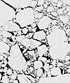 had called for their dissemination. Seven hundred of the photographs depict sea ice at six Arctic sites outside of the U.S., while 500 images show 22 sites in Alaskan waters. Scientists said that the extremely fine resolution of the spy satellite images — one yard — will enable them to better understand processes such as the formation of melted pools of water on the surface of sea ice, which hastens the disintegration of the ice. Scientists said that by studying the photographs — which span the last nine years, at least — they will be able to develop more accurate models of what might happen to Arctic sea ice as warming continues. “These… one-meter images… give you a big picture of the summertime Arctic,” said Thorsten Markus of NASA’s Goddard Space Flight Center, which studies climate change. “This is the main reason we are so thrilled about it.”
USGS
Satellite image of East Siberian Sea