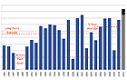
The Gulf of Mexico’s hypoxic zone, an oxygen-depleted area created by excessive nutrient pollution, is expected to reach record proportions this year as a result of the extreme flooding in the Mississippi River basin,
according to a forecast by the National Oceanic and Atmospheric Administration (NOAA). Using nutrient load data compiled by the U.S. Geological Survey, scientists calculate that the hypoxic zone, also known as the “dead zone,” could cover 8,500 to 9,421 square miles, an area about the size of New Hampshire. The dead zone — which is created when algal blooms remove oxygen from the water and suffocate marine life — has reached an average 6,000 square miles during the last five years. But with the flow rate of the Mississippi and Atchafalaya Rivers nearly double the normal rate this spring, the quantity of nutrients entering the Gulf is about 35 percent higher than usual, according to NOAA. The dead zone, located along the coast, forces Gulf fishermen farther offshore.
Largest Gulf ‘Dead Zone’ Anticipated in Wake of Spring Floods
More From E360
-
Biodiversity
As Jaguars Recover, Will the Border Wall Block Their U.S. Return?
-
WATER
An E.U. Plan to Slash Micropollutants in Wastewater Is Under Attack
-
INTERVIEW
This Data Scientist Sees Progress in the Climate Change Fight
-
Climate
As Floods Worsen, Pakistan Is the Epicenter of Climate Change
-
Climate
Heat Stress Is a Major Driver of India’s Kidney Disease Epidemic
-
Energy
It’s a ‘Golden Age’ for U.S. LNG Industry, But Climate Risks Loom
-
Climate
How Climate Risks Are Putting Home Insurance Out of Reach
-
INTERVIEW
Inside the Plastics Industry Playbook: Delay, Deny, and Distract
-
Biodiversity
Freeing Captive Bears from Armenia’s Backyards and Basements
-
Food & Agriculture
In Indonesia’s Rainforest, a Mega-Farm Project Is Plowing Ahead
-
FILM CONTEST WINNER
In the Yucatan, the High Cost of a Boom in Factory Hog Farms
-
INTERVIEW
In the Transition to Renewable Energy, China Is at a Crossroads