Citizen scientists interested in tracking the health of the planet’s forests have a new tool at their disposal. New software that uses satellite technology to map and
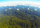
monitor changes in forested areas is being made available to the public through a free online course. Users who complete the course, hosted by Stanford University, can receive a license to operate the software, called CLASlite. CLASlite, or the Carnegie Landsat Analysis System lite, is a highly automated system for converting satellite imagery from its original, raw format into maps that can be used to detect deforestation, logging, and other disruptions. It was developed by Carnegie researcher Greg Asner to help governments, nongovernmental organizations, and academic institutions conduct high-resolution mapping and monitoring of forests. “We are making the science of forest monitoring broadly available to people who want and need to participate in tracking and managing the health of their forests,” said Asner.
A video explains the mapping software.