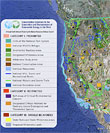
Working with Google Earth, two U.S. conservation groups have drafted detailed maps of 13 western states showing areas that might be suitable for renewable energy projects and marking regions that should be off-limits to development. The Natural Resources Defense Council, the National Audubon Society, and Google.org — the non-profit conservation arm of Google — are working with western governors and business interests to channel development of solar, wind, geothermal, and other alternative energy projects into areas where development will cause minimal disturbance to wildlife and the environment. The project, called the Path to Green Energy, is in response to the intensifying interest in building large-scale renewable energy projects, particularly in the West, with its ample sunshine in the southwest and high winds on the Great Plains. Areas that NRDC and Audubon say that should be off-limits to development include not only large swaths of state and federal lands, but also environmentally sensitive habitats, such as sage grouse territory in Wyoming. The use of Google Earth to map potential sites for renewable energy development is just one way in which Google Earth is increasingly being used by conservationists to monitor the environment.
Google Earth
