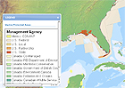
The latest version of the online North American Environmental Atlas, published this month, provides an interactive documentation of the continent’s marine ecosystems, including the first comprehensive map of the marine protected areas and the ranges for the continent’s most threatened marine species. Published by the Commission for Environmental Cooperation, a coalition of scientists from the U.S., Canada, and Mexico, the atlas assembles geospatial data on environmental conditions and trends continent-wide, including maps and interactive links. Scientists hope the new features on marine protected areas — including descriptions of which regions are currently under protection and which national, state, provincial, or territorial authorities manage them — will promote cooperation across political borders to strengthen marine biodiversity. Resources include an illustration of 28 priority conservation areas along the continent’s western coastline, from Baja to the Bering Sea, and an ecological scorecard of conservation areas based on the health of the water, habitat, and living resources. The atlas was created by scientists and map makers from Natural Resources Canada, the Instituto Nacional de EstadÃstica y GeografÃa in Mexico, and the U.S. Geological Survey.
Visit the site
Visit the site