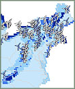
The Natural Resources Defense Council (NRDC) has produced interactive maps showing promising sites for developing renewable energy in the United States. The maps show, on a county-by-county basis, areas that have the most natural potential to generate energy from the sun, wind, biomass from wood and crop waste, and biogas from animal waste at livestock and poultry farms. The NRDC maps also depict renewable energy projects already in operation. The NRDC says that its interactive maps are designed to be used by legislators, investors, farmers, and other people interested in identifying private lands that might be suitable for renewable energy projects. Earlier this month, the NRDC, working with Google Earth and the Audubon Society, released maps showing areas on public lands in 13 western states where renewable energy should not be developed because of environmental concerns or legal restrictions on development.
NRDC