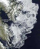
Every day, NASA’s Earth Observatory publishes images of our world from a perspective rarely seen by human eyes — from satellites high above the planet’s surface. In 2009, these images once again provided an extraordinary view of the powerful forces of nature, of the widening footprint of human civilization, and of the point where they often meet. In February, NASA satellite photos captured the massive brushfires roaring through southeastern Australia. Two months later, the space agency’s cameras documented the Aral Sea’s disappearance. The images expanded our view of how human land use is reshaping our world, from the patchwork farms of the U.S. Midwest to the building boom in Dubai. And the photographs illustrated that, from miles above, even the murky sediment in the Gulf of Mexico or a violent sandstorm off the Senegal coast can have a delicate beauty. Click to see a gallery of some of the more memorable images from the year.
NASA: The Year in Images
More From E360
-
Energy
A Home Battery Revolution Is Reshaping the Power Grid
-
Energy
In East Africa, a Controversial Oil Project Is Poised for Production
-
Climate
A Missing Piece in Climate Models: Nature’s Own Emissions
-
INTERVIEW
An EPA Researcher Details the Agency’s Assault on Science
-
Oceans
Efforts to Save Kelp Forests from Ocean Warming Are Ramping Up
-
Biodiversity
Pollution Is Changing the Smells of Nature, With Risks for Wildlife
-
Oceans
Supertrawlers Are Taking Antarctic Krill That Whales Depend On
-
INTERVIEW
The U.S. Senator Who Won’t Shut Up about Climate Change
-
Energy
A First Among Major Nations, India Is Industrializing With Solar
-
A NOTE FROM THE EDITOR
After Two Decades, E360’s Founder and Editor Is Moving On
-
Solutions
Restoring the Flow: A Milestone in the Revival of the Everglades
-
Climate
Why Fears Are Growing Over the Fate of a Key Atlantic Current