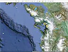
The latest version of Google Earth includes a vast area missing from earlier versions of the software — the undersea world. The popular software, which enables users to scan satellite photos of the earth in minute detail, now takes readers on a virtual tour of the world’s oceans. Viewers can watch animated videos of deep ocean canyons, click on images of rare sea life, and visit a 3D model of Aquarius, the world’s only underwater laboratory. A partner in compiling the new version of the software is ocean explorer Sylvia Earle, a former chief scientist at the National Oceanic and Atmospheric Administration. In a video released as part of the launch of the new undersea version, Earle recalls that in 2006 she said to Google Earth’s John Hanke, “You’ve done a great job with the dirt. But what about the water?” The new software can be downloaded at earth.google.com.
New Version of Google Earth Simulates Details of Ocean Floor
More From E360
-
Solutions
From Ruins to Reuse: How Ukrainians Are Repurposing War Waste
-
ANALYSIS
Carbon Offsets Are Failing. Can a New Plan Save the Rainforests?
-
Energy
Facing a Hostile Administration, U.S. Offshore Wind Is in Retreat
-
Biodiversity
As Jaguars Recover, Will the Border Wall Block Their U.S. Return?
-
WATER
An E.U. Plan to Slash Micropollutants in Wastewater Is Under Attack
-
INTERVIEW
This Data Scientist Sees Progress in the Climate Change Fight
-
Climate
As Floods Worsen, Pakistan Is the Epicenter of Climate Change
-
Climate
Heat Stress Is a Major Driver of India’s Kidney Disease Epidemic
-
Energy
It’s a ‘Golden Age’ for U.S. LNG Industry, But Climate Risks Loom
-
Climate
How Climate Risks Are Putting Home Insurance Out of Reach
-
INTERVIEW
Inside the Plastics Industry Playbook: Delay, Deny, and Distract
-
Biodiversity
Freeing Captive Bears from Armenia’s Backyards and Basements
