A dike, the green strip along the coast, protects flower fields and wind turbines in the northern Netherlands.

This promenade in the HafenCity district of Hamburg is designed to withstand flooding. An elevated roadway passes behind it.

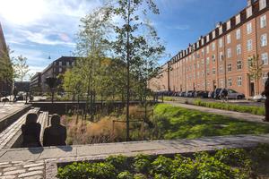
Hamburg's HafenCity is partially protected against storm surges and rising seas. The area encompasses the islands in the right two-thirds of photo.

The Maeslant Barrier in the Netherlands. When waters reach 10 feet above normal sea level, the massive gates are closed to protect Rotterdam and other areas from storm surges.

A multifunction dike in Rotterdam that serves as both a dike and commercial shopping area. Below the dike’s grass-covered surface are shops that would be flooded if storm surges reach extreme levels.

A so-called “room for the river” project in the Netherlands that uses floodplains to prevent flooding in Rotterdam and Dordrecht.

A view of downtown Rotterdam, the Netherlands. “Fighting water,” says a Dutch official, “is a war you never win.”

In the northern Netherlands, beach stabilization projects and a dike, just beyond the sand, protect a town.

A dike in the Wilhelmsberg section of Hamburg, where some areas are 22 feet below sea level.

This embayment near the Wilhemsberg section of Hamburg was created to allow in river water and slightly relieve flooding.

Hamburg is Europe's second largest port and sits in an inland delta of the Elbe River, which flows into the North Sea.

A dike protects a village downstream from Hamburg. Some propose that agricultural areas, such as the orchards, right, should be opened for flooding during high water.

The vulnerability of Dordrecht, the Netherlands, is seen in this photo. The city is protected by the Maeslant Barrier, but could be threatened in the future by rising sea levels.