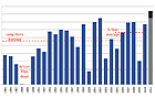
The Gulf of Mexico’s hypoxic zone, an oxygen-depleted area created by excessive nutrient pollution, is expected to reach record proportions this year as a result of the extreme flooding in the Mississippi River basin,
according to a forecast by the National Oceanic and Atmospheric Administration (NOAA). Using nutrient load data compiled by the U.S. Geological Survey, scientists calculate that the hypoxic zone, also known as the “dead zone,” could cover 8,500 to 9,421 square miles, an area about the size of New Hampshire. The dead zone — which is created when algal blooms remove oxygen from the water and suffocate marine life — has reached an average 6,000 square miles during the last five years. But with the flow rate of the Mississippi and Atchafalaya Rivers nearly double the normal rate this spring, the quantity of nutrients entering the Gulf is about 35 percent higher than usual, according to NOAA. The dead zone, located along the coast, forces Gulf fishermen farther offshore.
Largest Gulf ‘Dead Zone’ Anticipated in Wake of Spring Floods
More From E360
-
Solutions
Beyond Lithium: New Battery Tech Starts to Break Through
-
INTERVIEW
What Do We Actually Know About the Microplastics Inside Us?
-
Energy
A Home Battery Revolution Is Reshaping the Power Grid
-
Energy
In East Africa, a Controversial Oil Project Is Poised for Production
-
Climate
A Missing Piece in Climate Models: Nature’s Own Emissions
-
INTERVIEW
An EPA Researcher Details the Agency’s Assault on Science
-
Oceans
Efforts to Save Kelp Forests from Ocean Warming Are Ramping Up
-
Biodiversity
Pollution Is Changing the Smells of Nature, With Risks for Wildlife
-
Oceans
Supertrawlers Are Taking Antarctic Krill That Whales Depend On
-
INTERVIEW
The U.S. Senator Who Won’t Shut Up about Climate Change
-
Energy
A First Among Major Nations, India Is Industrializing With Solar
-
A NOTE FROM THE EDITOR
After Two Decades, E360’s Founder and Editor Is Moving On